
價格:免費
更新日期:2018-07-16
檔案大小:30.5 MB
目前版本:1.1
版本需求:需要 iOS 10.2 或以上版本。與 iPhone、iPad 及 iPod touch 相容。
支援語言:英語

Located almost in the center of the North Aegean, Skyros and its numerous satellite islets form a small, rather isolated archipelago. It is a place that fascinates with the intense landscape contrasts and the cultural features. Skyros is a destination with a unique identity, the place for the educated visitor.
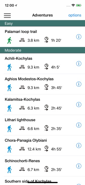
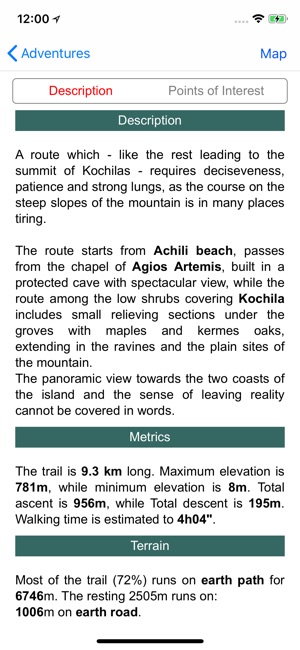
Skyros topoguide is a digital field guide for hikers and nature lovers. It includes routes, descriptions and photos for 9 hiking trails along the beautiful island of Skyros.
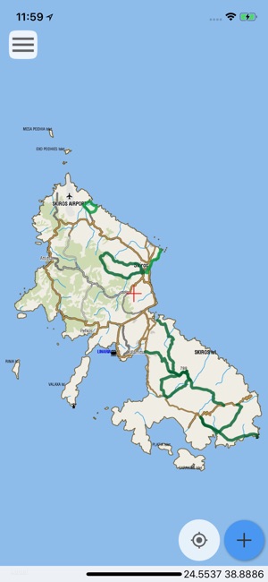
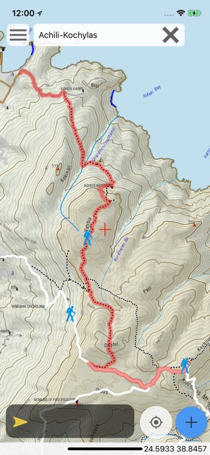
The application offers detailed off-line maps and an extensive introduction on geography, geology, the nature and the rich ancient history of Skyros island, including a large chapter on the island's nature, as well as presentations of the prehistoric city of Palamari and the Skyros castle.
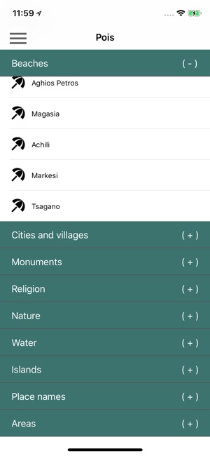
The app offers also a useful list of POIs with a comprehensive search engine.
The trails list includes easy and moderate hiking trails and long mountain traverses, of a total length of 65 km.
In the field, the app identifies the nearest adventure, guides you to it and then along it by displaying messages and warnings on every junction or other important location. On each Point of Interest, photos and texts are displayed on the map. If the hiker gets off-trail, the app indicates the shorter way to get back safely.
The cartographic company AnaDigit, creator of the application, has issued previously hundreds of detailed hiking maps for Greece (eg. maps of Mt. Olympus,Crete, Zagori, Sifnos, Naxos and other Aegean islands). To build the application and ensuring data accuracy, all paths of Skyros island have been revised during Spring of 2018.
支援平台:iPhone, iPad